Crops and technologies On crops, livestock, fisheries, irrigation, technologies, production and more.
Landscapes and biodiversity On land, landscapes, forests and forestry, biodiversity, ecosystems, ecology and more.
Nutrition and health On nutrition, malnutrition and overnutrition as well as health, diets, diseases and more.
Social Inclusion On inclusion, social classes, social groups, social participation, social protection, Indigenous peoples and more.
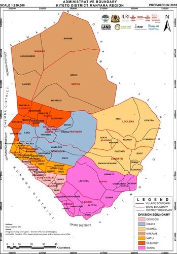
Map Administrative boundary Kiteto District, Manyara Region Kalenzi, D. 2018. Administrative boundary Kiteto District, Manyara Region. Nairobi, Kenya: ILRI.
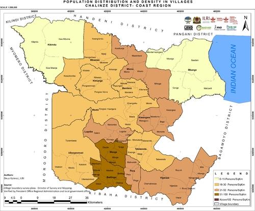
Map Population distribution and density in villages in Chalinze District, Coast Region Kalenzi, D. 2018. Population distribution and density in villages in Chalinze District, Coast Region. Nairobi, Kenya: ILRI.
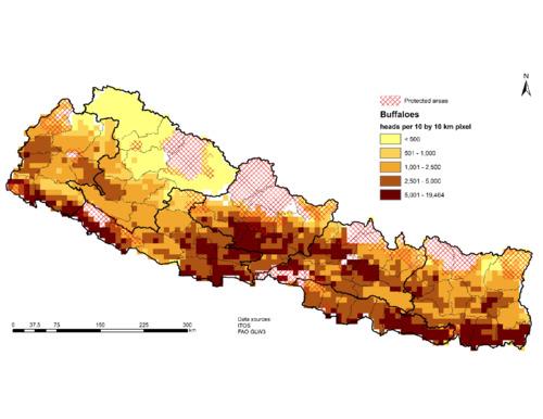
Map Series of thematic maps on biophysical and socioeconomic status of Nepal to guide targeting of agricultural technologies Sonder, K., & Lopez-Ridaura, S. (2023). Series of thematic maps on biophysical and socioeconomic status of Nepal to guide targeting of agricultural technologies. Mexico. CIMMYT. https://hdl.handle.net/10883/23053
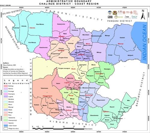
Map Administrative boundary Chalinze District, Coast Region Kalenzi, D. 2018. Administrative boundary Chalinze District, Coast Region. Nairobi, Kenya: ILRI.
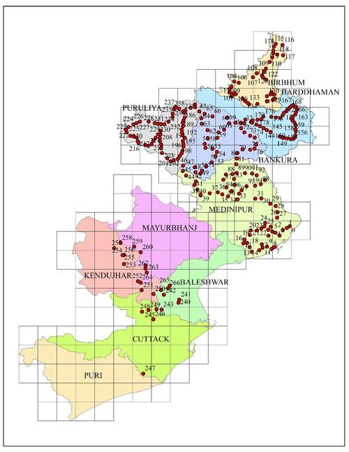
Map Map of ground truth data points in West Bengal and Odissa Chandrashekhar Biradar. (28/10/2015). Map of ground truth data points in West Bengal and Odissa
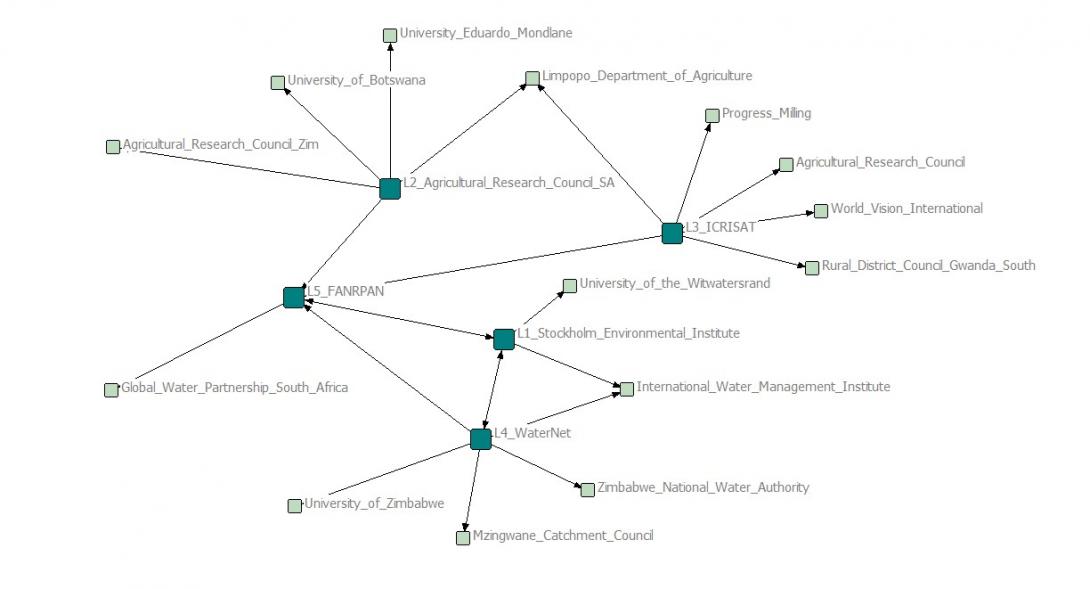
Map LBDC Project Partner Map CGIAR Challenge Program on Water and Food. 2013. LBDC Project Partner Map. Pretoria, South Africa: CPWF.