Thenkabail, Prasad. 2003. The use of remote sensing for the characterization of large river basins: issues pertaining to Challenge Program benchmark basins. [Working Paper] Colombo, Sri Lanka: IWMI. Challenge Program Secretariat. 1 CD.
IWMI-Giriraj Amarnath, 'Monthly maximum flood inundation extent derived using MODIS 8-day 500m surface reflectance data for South East Asia (2001-Nov)', IWMI-Giriraj Amarnath, 2015
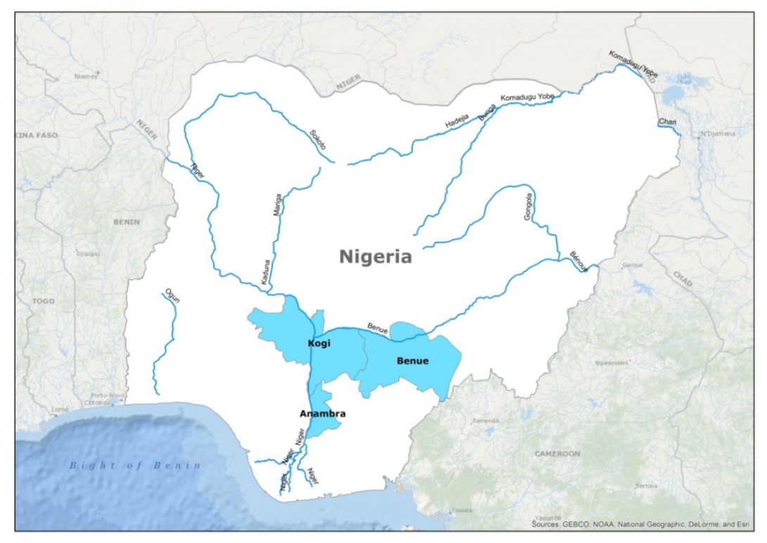
IWMI-Giriraj Amarnath, 'Maximum flood inundation extent derived using MODIS 8-day 500m surface reflectance data for Nigeria (2000353)', IWMI-Giriraj Amarnath, 2015
IWMI-Giriraj Amarnath, 'Maximum flood inundation extent derived using MODIS 8-day 500m surface reflectance data for Nigeria (2001025)', IWMI-Giriraj Amarnath, 2015
IWMI-Giriraj Amarnath, 'Maximum flood inundation extent derived using MODIS 8-day 500m surface reflectance data for Nigeria (2012025)', IWMI-Giriraj Amarnath, 2015
IWMI-Giriraj Amarnath, 'Monthly maximum flood inundation extent derived using MODIS 8-day 500m surface reflectance data for Nigeria (2006-Jan)', IWMI-Giriraj Amarnath, 2015
IWMI-Giriraj Amarnath, 'Monthly maximum flood inundation extent derived using MODIS 8-day 500m surface reflectance data for Nigeria (2009-Jun)', IWMI-Giriraj Amarnath, 2015
IWMI-Giriraj Amarnath, 'Monthly maximum flood inundation extent derived using MODIS 8-day 500m surface reflectance data for Nigeria (2011-Jul)', IWMI-Giriraj Amarnath, 2015
IWMI, 'Eight-day maximum flood inundation extent for South Asia using MODIS time-series imagery (MOD09A12003353.tif)', International Water Management Institute, 2013