Crops and technologies On crops, livestock, fisheries, irrigation, technologies, production and more.
Landscapes and biodiversity On land, landscapes, forests and forestry, biodiversity, ecosystems, ecology and more.
Nutrition and health On nutrition, malnutrition and overnutrition as well as health, diets, diseases and more.
Social Inclusion On inclusion, social classes, social groups, social participation, social protection, Indigenous peoples and more.
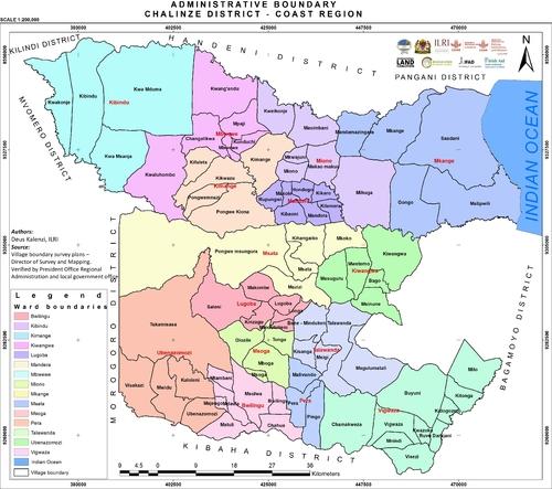
Map Administrative boundary Chalinze District, Coast Region Kalenzi, D. 2018. Administrative boundary Chalinze District, Coast Region. Nairobi, Kenya: ILRI.
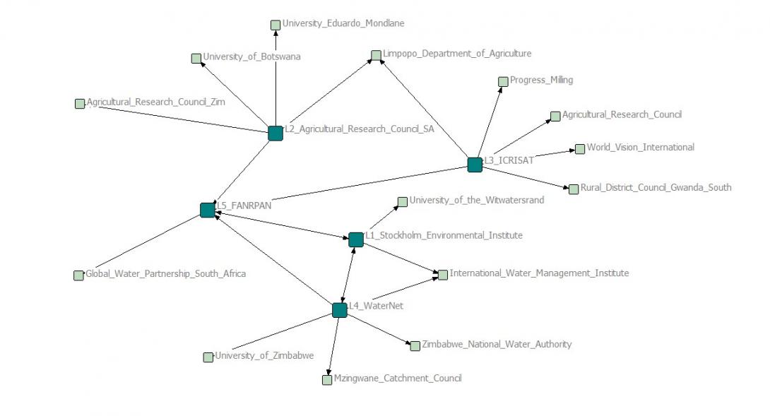
Map LBDC Project Partner Map CGIAR Challenge Program on Water and Food. 2013. LBDC Project Partner Map. Pretoria, South Africa: CPWF.
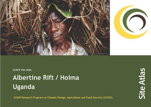
Map CCAFS site atlas – Albertine Rift / Hoima Sijmons K, Kiplimo J, Förch W, Thornton PK, Radeny M, Kinyangi J. 2013. CCAFS site atlas – Albertine Rift / Hoima. CCAFS Site Atlas Series. Copenhagen, Denmark: The CGIAR Research Program on Climate Change, Agriculture and Food Security (CCAFS).